

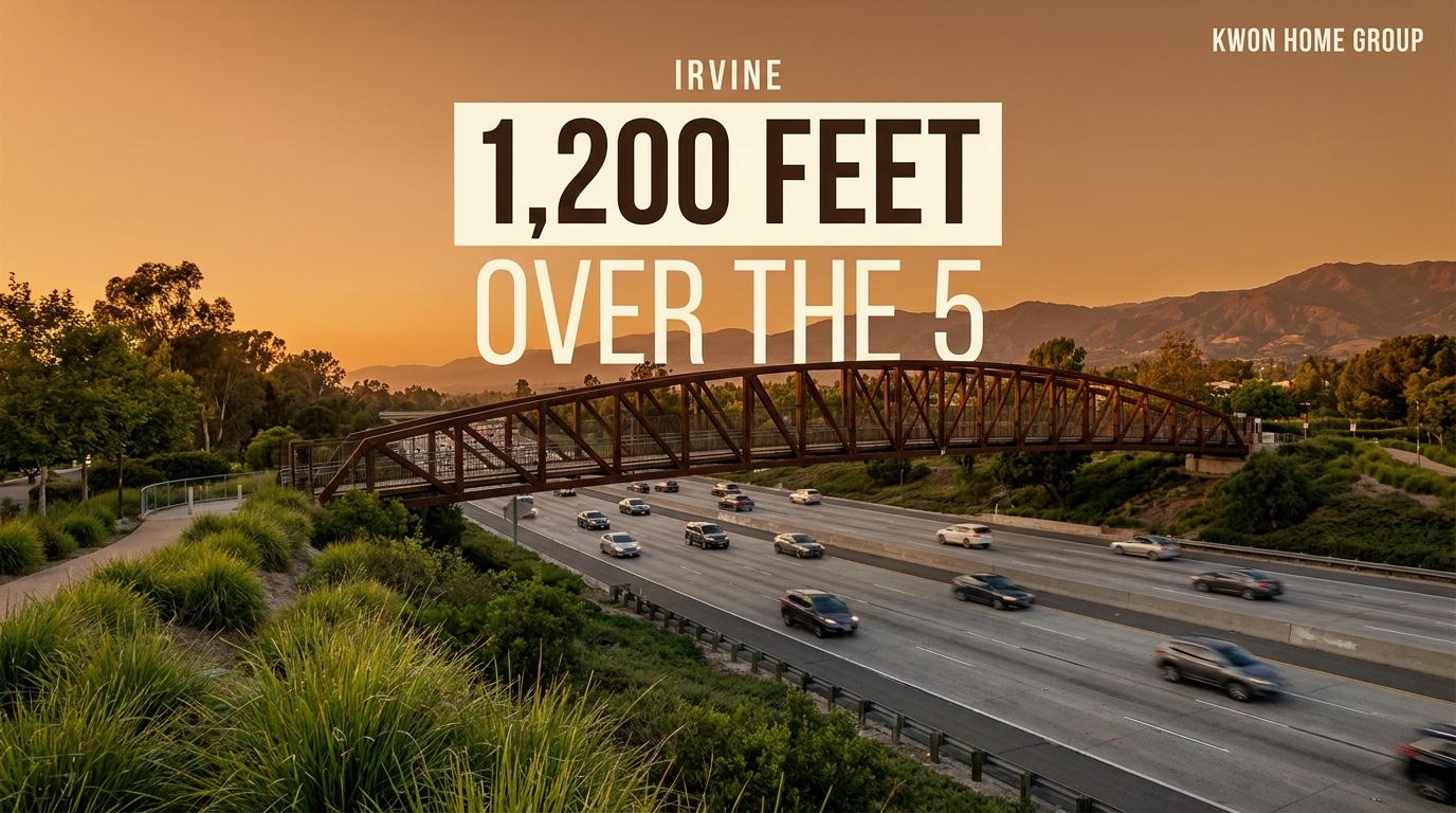
The short version: On Tuesday, August 11, Irvine cut the ribbon on the Jeffrey Open Space Trail Bicycle & Pedestrian Bridge — nearly 1,200 feet long, 15 feet wide, spanning the I-5 Freeway, the Jeffrey Road Park & Ride lot, and Walnut Avenue. It is now the largest pedestrian and bicycle bridge in the city. On the north side it ties into the existing Jeffrey Open Space Trail and the Cypress Village Trail; on the south side it connects to the JOST extension, which now runs from Walnut down to Smoke Tree and will eventually reach Barranca Parkway. Mayor Larry Agran described it as completing "a vital 5-mile corridor through the heart of our City." The project cost was covered largely by $14.5 million in state funding plus about $5.06 million from Caltrans. For homeowners in Cypress Village, Stonegate, Woodbury, Portola Springs and Northwood, the freeway stopped being a wall this week.
Most of the coverage on this has been ribbon-cutting photos and stats about how long the bridge is. Fun, but it buries the part that actually matters if you own a house near it.
For as long as anyone has lived in north Irvine, the I-5 has been the hard edge of the neighborhood. You could walk or ride the Jeffrey Open Space Trail all the way down from the foothills — and then you hit the freeway and you were done. If you wanted to keep going south, you got in the car. That's the thing that changed on Tuesday.
What Actually Got Built
Let's get the facts straight first, because the numbers are genuinely impressive.
The bridge is nearly 1,200 feet long and 15 feet wide. The City's own frame of reference: that's more than three football fields end to end, about five Boeing 747s lined up nose to tail, or four times the height of the Statue of Liberty. It sits south of and adjacent to Jeffrey Road, and it crosses three things at once — the I-5 Freeway, the Jeffrey Road Park & Ride parking lot, and Walnut Avenue.
It's built as a Class I bicycle and pedestrian facility, which is the designation that matters. Class I means fully separated from car traffic — not a painted stripe on the shoulder, not a sharrow. You're on your own path the whole way.
The detail work is not cheap-looking, either: about 2,400 linear feet of steel truss railing, 40 custom-designed decorative steel plate light poles, landscaping, and roughly 300 linear feet of decorative block walls finished in Italian Villa stone veneer. The lighting was designed so the bridge works at night, which for a commuter path is not a small thing.
Construction started in March 2024. Funding came primarily from $14.5 million in state money secured by U.S. Representative Dave Min back when he served as State Senator, plus an additional $5,056,000 from Caltrans.
The Part Nobody Has Written Yet
Here's the map change, in plain English.
The original Jeffrey Open Space Trail opened in 2015 with about 3.5 miles of meandering trail and art installations tracing the history of the area. It's the green spine that runs down through the middle of north Irvine. If you live in Woodbury, Stonegate, Cypress Village, Portola Springs or Northwood, you know it — it's the one everybody actually uses.
What it never had was a way across the freeway.
Now it does. On the north end, the bridge connects into the existing JOST and the Cypress Village Trail. On the south end, it links to the JOST extension, which has been pushed from Walnut down to Smoke Tree and is planned to continue to Barranca Parkway. Put together, that's a continuous, car-free, roughly five-mile spine running north–south through the middle of Irvine.
And that spine isn't an island. The City is explicit that this is one piece of a regional trail network stretching from the Pacific Ocean up to the Santa Ana Mountains and the Cleveland National Forest. Closing the I-5 gap was the missing link that makes the rest of it usable on foot or by bike.
So Which Villages Actually Benefit?
Let me be careful here, because this is where posts like this usually start making things up. I'm not going to quote you a percentage that trail access adds to a home's value — nobody has run that study on this bridge, and anyone who tells you a number this week is guessing.
What I can tell you is which neighborhoods materially changed, and what I see buyers respond to.
Cypress Village and Cypress Village East. The biggest winner, and it's not close. The Cypress Village Trail feeds directly into the north landing of the bridge. Cypress Village already carries a Bike Score around 72 against a Walk Score around 42 — meaning it has always been a better place to ride than to walk. This bridge widens the gap in the good direction. If you're in Cypress Village, your bike range roughly doubled overnight.
Stonegate and Woodbury. Both sit right along the JOST spine north of the crossing. They get the full corridor without doing anything. For families here, the practical version is that a weekend ride no longer dead-ends at a freeway sound wall.
Portola Springs. Furthest up the spine, in the foothills, and the one I get asked about most. The trail network in Portola Springs already connects up toward the ridge and open space — the Silverado Trail, the paths through the village's 19 parks. What the bridge adds is the other direction. From the top of the village you can now, in theory, ride a continuous protected route all the way down and across the 5. That's a very different pitch to a buyer than "we have nice trails."
Northwood. Sits alongside the Jeffrey corridor and picks up the same benefit, with the added convenience of the Jeffrey Road Park & Ride sitting right under the bridge — which matters if you combine a bike leg with a bus or a carpool.
The honest boundary on all of this: the bridge does not connect you to the Great Park. The south landing puts you toward Walnut and Smoke Tree, heading eventually toward Barranca. If you're shopping Great Park villages, this is a nice regional amenity, not a doorstep one. I'd rather say that plainly than let you buy on a misread.
What This Does to a Listing
I've sold enough homes in these villages to know how buyers actually behave, so here's the practical read.
Irvine buyers price schools and square footage first. Nobody has ever paid more for a house because of a trail. But trails are a tiebreaker, and in a market where two similar homes in two similar villages are sitting side by side, tiebreakers decide offers. Connectivity is the kind of amenity that makes a neighborhood feel bigger than it is — and "you can ride from here to the ocean without crossing traffic" is a genuinely good line at an open house.
There's a second-order effect worth naming too. Irvine's newer villages get criticized for being drive-first — my own Portola Springs guide says it out loud, because it's true. Infrastructure like this chips at that criticism. It won't turn north Irvine into a walkable urban core. But it does move the needle on the specific complaint that these villages are pretty pods you have to drive out of.
If you own here: this is a free amenity upgrade. Nothing about your taxes, HOA or Mello-Roos changed, and your village got a piece of infrastructure worth roughly $20 million in outside funding. Take the win. If you're listing in the next year, get the trail access into the marketing — most agents won't bother.
If you're buying: go ride it before you tour. Seriously. Twenty minutes on the bridge and the corridor will tell you more about whether north Irvine fits your life than any number I can put in a spreadsheet. If the answer is yes, it should reshape which villages you're looking at.
Go See It
It's open now. Park at the Jeffrey Road Park & Ride and walk up, or just pick up the JOST anywhere along Jeffrey and head south until you run out of trail — which, for the first time in eleven years, you won't.
The lighting design means it's worth doing at dusk. And if you want the honest version of what any of this means for your specific street and your specific home, let's talk — or if you're just curious where your value sits right now, start here.
Frequently Asked Questions
When did the Jeffrey Open Space Trail bridge open in Irvine?
The JOST Bicycle & Pedestrian Bridge opened Tuesday, August 11, 2026, with a ribbon-cutting ceremony from 9 to 10 a.m. It is open to the public now.
How long is Irvine's new pedestrian bridge?
It is nearly 1,200 feet long and 15 feet wide, making it the largest pedestrian and bicycle bridge in Irvine. For scale, that is longer than three football fields.
What does the JOST bridge cross?
The bridge spans the I-5 Freeway, the Jeffrey Road Park & Ride parking lot, and Walnut Avenue. It is located south of and adjacent to Jeffrey Road.
Which Irvine neighborhoods does the JOST bridge connect?
On the north side it connects to the existing Jeffrey Open Space Trail and the Cypress Village Trail, serving Cypress Village, Stonegate, Woodbury, Portola Springs and Northwood. On the south side it connects to the JOST extension running from Walnut to Smoke Tree, with a planned continuation to Barranca Parkway.
How much did the JOST bridge cost and who paid for it?
The project was supported by $14.5 million in state funding secured by U.S. Representative Dave Min during his time as State Senator, plus an additional $5,056,000 from Caltrans.
Does the JOST bridge connect to the Great Park?
Not directly. The southern landing heads toward Walnut Avenue and Smoke Tree, with a planned extension to Barranca Parkway. The Great Park is served by its own trail and park network.
Is the Jeffrey Open Space Trail separated from car traffic?
Yes. The trail and bridge are built as a Class I bicycle and pedestrian facility, meaning the path is fully separated from vehicle traffic rather than sharing the road.